

Explore
Giant & Ancient Trees of Japan
Japan’s nationally designated Natural Monument trees, and the trees in my Journal, on one map, each with a photograph and its sources.
- 167 trees
- 45 prefectures
- 15 featured in the Journal
- CC photos under open licences
From the Journal
Trees from the articles
15 trees I have written about. Each card opens the article.
-

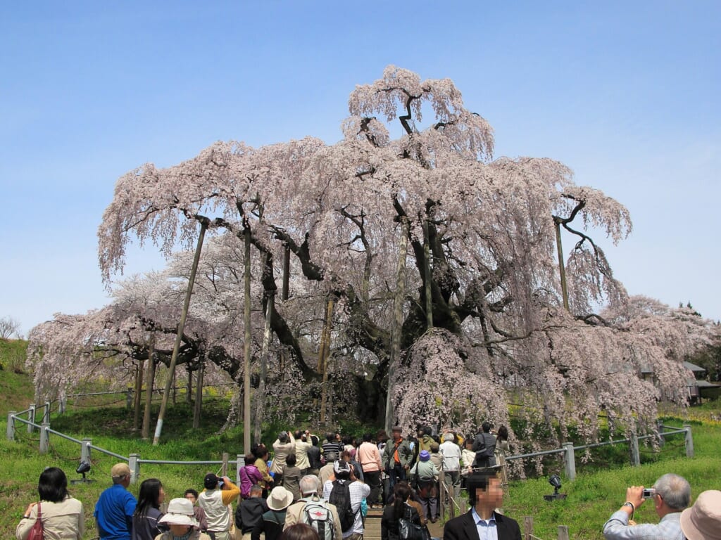
Photo: 掬茶 · CC BY-SA 4.0 -

Photo: 京浜にけ at Japanese Wikipedia · CC BY-SA 3.0 -
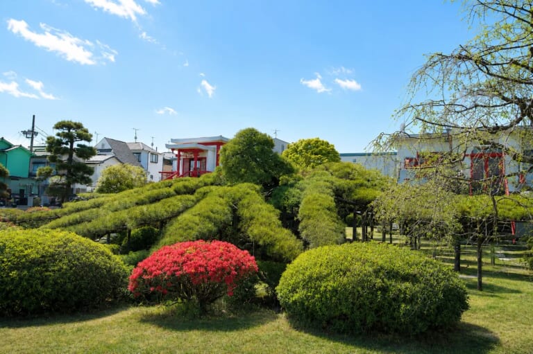
Photo: Isaki Kasahara · All rights reserved -

Photo: Opqr · CC BY-SA 4.0 -

Photo: 島倉徳八 · CC BY-SA 3.0 -

Photo: Aimaimyi · CC BY-SA 3.0 -

Photo: Σ64 · CC BY 3.0 -

Photo: Guilhem Vellut from Annecy, France · CC BY 2.0 -

Photo: 京浜にけ at Japanese Wikipedia · CC BY-SA 3.0 -

Photo: Serenityprayer · CC BY-SA 4.0 -

Photo: Alpsdake · CC BY-SA 4.0 -

Photo: 宮内庁京都事務所 / Kyoto Office, Imperial Hous… · CC BY 4.0 Ukon no Tachibana and Sakon no Sakura, Shishinden, Kyoto Imperial Palace
紫宸殿の右近の橘・左近の桜
In this article
-

Photo: Gpwitteveen · CC BY-SA 3.0 -

Photo: かるちる · CC0 -

Photo: Tam0031 · CC BY-SA 3.0


The map
Find a tree
Search by name, species or place. Select a card, or a dot on the map, to see a tree.
- Natural Monument
- In the Journal
- Ring: Special Natural Monument
All trees
Browse the 167 trees
167 trees, from north to south.
-

Photo: あおもりくま(Aomorikuma) · CC BY-SA 3.0 -

Photo: Mizushimasea · CC BY-SA 4.0 Chosen-ji Great Ginkgo
長泉寺の大イチョウ
-

Photo: さかおり · CC BY-SA 4.0 Fujishima Wisteria
藤島のフジ
-
Photo: 掬茶 · CC BY-SA 4.0 -

Photo: Yauchi · CC BY-SA 4.0 -

Photo: さかおり · CC BY-SA 4.0 -

Photo: Ty19080914 · CC BY-SA 4.0 Weeping Katsura of Morioka
シダレカツラ
-

Photo: suzune konoo · CC BY-SA 3.0 Amago Ginkgo
雨乞のイチョウ
-

Photo: Ty19080914 · CC BY-SA 4.0 Giko-ji Umbrella Pine
祗劫寺のコウヤマキ
-

Photo: クリオネサラダ · CC BY-SA 3.0 Shomyo-ji Shii
称名寺のシイノキ
-

Photo: Mizu basyo · CC BY-SA 4.0 Tosho-ji Marumi Kaya
東昌寺のマルミガヤ
-

Photo: 掬茶 · CC BY-SA 4.0 Kakunodate Cherry
角館のシダレザクラ
-

Photo: 掬茶 · CC BY-SA 4.0 -

Photo: Resolution.2100 · CC BY-SA 4.0 -

Photo: さかおり · CC BY-SA 4.0 -

Photo: Tomofumi Sato · CC BY-SA 3.0 Isazawa Kubo-zakura Cherry
伊佐沢の久保ザクラ
-

Photo: Duff Figgy · CC BY-SA 3.0 -

Photo: Duff Figgy · CC BY-SA 3.0 -

Photo: さかおり · CC BY 4.0 -

Photo: さかおり · CC BY-SA 4.0 -
Photo: 京浜にけ at Japanese Wikipedia · CC BY-SA 3.0 -

Photo: さかおり · CC BY 4.0 -

Photo: MAKIKO OMOKAWA · CC BY-SA 3.0 Sawajiri Great Cypress
沢尻の大ヒノキ(サワラ)
-

Photo: さかおり · CC BY 4.0 -

Photo: さかおり · CC BY 4.0 -

Photo: Fumihiko Ueno · CC BY 3.0 -

Photo: さかおり · CC BY 4.0 -

Photo: 小石川人晃 · CC BY-SA 4.0 Odo Cherry
大戸のサクラ
-

Photo: Miyuki Meinaka · CC BY-SA 4.0 Sakuragawa Cherry
桜川のサクラ
-

Photo: さかおり · CC BY 4.0 Shirahatayama Hachimangu Shrine Ohatsuki Ginkgo
白旗山八幡宮のオハツキイチョウ
-

Photo: KENPEI · CC BY-SA 3.0 Kongo-zakura Cherry
金剛ザクラ
-

Photo: さかおり · CC BY 4.0 -

Photo: ja:User:㭍月例祭 · CC0 Haramachi Great Zelkova
原町の大ケヤキ
-

Photo: さかおり · CC BY 4.0 -

Photo: さかおり · CC BY-SA 4.0 Usune Great Mulberry
薄根の大クワ
-

Photo: さかおり · CC BY-SA 4.0 -

Photo: 京浜にけ · CC BY-SA 3.0 Ishito Gama-zakura Cherry
石戸蒲ザクラ
-

Photo: ja:User:京浜にけ · CC BY-SA 4.0 Ushijima Wisteria
牛島のフジ
-

Photo: さかおり · CC BY-SA 4.0 -

Photo: katorisi · CC BY 2.5 Fuma Great Camphor
府馬の大クス
-

Photo: Tak1701d · CC BY-SA 3.0 Kiyosumi Great Cedar
清澄の大スギ
-

Photo: Higa4 · CC0 Kozaki Great Camphor
神崎の大クス
-

Photo: 三人日 · CC BY-SA 4.0 -
Photo: Isaki Kasahara · All rights reserved -

Photo: Mizushimasea · CC BY-SA 4.0 -

Photo: 星組背番号10 · CC BY-SA 3.0 Nerima Hakusan Shrine Great Zelkova
練馬白山神社の大ケヤキ
-

Photo: Yobito KAYANUMA · CC BY-SA 3.0 Oshima Cherry Stump
大島のサクラ株
-

Photo: Sakaori (talk) · CC BY 3.0 Sajikami Shrine Hornbeam
幸神神社のシダレアカシデ
-

Photo: Paul O'Leary McCann · CC0 Zenpuku-ji Ginkgo
善福寺のイチョウ
-
Photo: Guilhem Vellut from Annecy, France · CC BY 2.0 -

Photo: Σ64 · CC BY-SA 3.0 -

Photo: さかおり · CC BY 4.0 -

Photo: Saigen Jiro · CC0 -

Photo: Tengoro · CC BY-SA 3.0 Shogun Cedar
将軍スギ
-

Photo: Asturio Cantabrio · CC BY-SA 4.0 -

Photo: 藤谷良秀 · CC BY-SA 3.0 Jonichi-ji Ginkgo
上日寺のイチョウ
-

Photo: さかおり · CC BY-SA 4.0 Wakidani Horse Chestnut
脇谷のトチノキ
-

Photo: そらみみ · CC BY-SA 4.0 Dogata Shii
堂形のシイノキ
-

Photo: Namazu-tron · Public domain Kayano Great Cedar
栢野の大スギ
-

Photo: さかおり · CC BY-SA 4.0 Sugimori Shrine Ohatsuki Ginkgo
杉森神社のオハツキイチョウ
-

Photo: さかおり · CC BY-SA 4.0 Tsunekami Cycad
常神のソテツ
-

Photo: さかおり · CC BY-SA 4.0 Hongoku-ji Ohatsuki Ginkgo
本国寺のオハツキイチョウ
-

Photo: さかおり · CC BY-SA 4.0 Jotaku-ji Ohatsuki Ginkgo
上沢寺のオハツキイチョウ
-

Photo: さかおり · CC BY-SA 4.0 Kochozen-ji Juniper
古長禅寺のビャクシン
-

Photo: Sakaori (talk) · CC BY-SA 3.0 Mitsue Great Zelkova
三恵の大ケヤキ
-

Photo: NekoJaNekoJa · CC BY-SA 3.0 Negoya Shrine Great Zelkova
根古屋神社の大ケヤキ
-

Photo: さかおり · CC BY-SA 4.0 Shoji Great Cedar
精進の大スギ
-

Photo: さかおり · CC BY-SA 4.0 Uenohara Great Zelkova
上野原の大ケヤキ
-

Photo: Sakaori (talk) · CC BY-SA 3.0 Utsukushimori Great Azalea
美森の大ヤマツツジ
-

Photo: さかおり · CC BY-SA 4.0 -

Photo: さかおり · CC BY-SA 4.0 Yamanokami Wisteria
山ノ神のフジ
-
Photo: 京浜にけ at Japanese Wikipedia · CC BY-SA 3.0 -

Photo: さかおり · CC BY-SA 4.0 Higashiuchi Hackberry
東内のシダレエノキ
-

Photo: photo: Qurren (talk) Taken with Canon … · CC BY-SA 3.0 Suzakura Shrine Jindai-zakura Cherry
素桜神社の神代ザクラ
-

Photo: Asturio Cantabrio · CC BY-SA 4.0 Tsukize Great Cedar
月瀬の大スギ
-

Photo: Monami · CC BY-SA 3.0 Chujohime Seigan-zakura Cherry
中将姫誓願ザクラ
-
Photo: Opqr · CC BY-SA 4.0 -
Photo: Serenityprayer · CC BY-SA 4.0 -
Photo: 島倉徳八 · CC BY-SA 3.0 -

Photo: alpsdake · Public domain Itoshiro Cedar
石徹白のスギ
-

Photo: T-mercury · CC BY-SA 3.0 Kabuchi Shrine Great Cedar
神淵神社の大スギ
-

Photo: 大野 一将 · CC0 -

Photo: GAVVA · Public domain Kashimo Cedar
加子母のスギ
-
Photo: Alpsdake · CC BY-SA 4.0 -

Photo: さかおり · CC BY 4.0 -

Photo: Sablier de Verrie · CC BY-SA 4.0 -
Photo: Aimaimyi · CC BY-SA 3.0 -

Photo: さかおり · CC BY-SA 4.0 -

Photo: Batholith · Public domain -

Photo: Batholith · Public domain Mishima Shrine Osmanthus
三島神社のキンモクセイ
-

Photo: さかおり · CC BY-SA 4.0 Noman-ji Cycad
能満寺のソテツ
-

Photo: さかおり · CC BY 4.0 Renchaku-ji Bayberry
蓮着寺のヤマモモ
-

Photo: さかおり · CC BY-SA 4.0 Ryuge-ji Cycad
龍華寺のソテツ
-

Photo: Saigen Jiro · CC0 Shinmachi Great Cycad
新町の大ソテツ
-

Photo: Batholith · Public domain Sugihokowakenomikoto Shrine Great Camphor
杉桙別命神社の大クス
-

Photo: さかおり · CC BY-SA 4.0 Yuya Long Wisteria
熊野の長フジ
-

Photo: Bariston · CC BY-SA 4.0 -

Photo: そらみみ (Soramimi) · CC BY-SA 4.0 -

Photo: Asturio Cantabrio · CC BY-SA 4.0 Seida Great Camphor
清田の大クス
-

Photo: さかおり · CC BY-SA 4.0 -

Photo: Tomio344456 · CC BY-SA 4.0 Sugimoto Jogan Cedar
杉本の貞観スギ
-

Photo: Asturio Cantabrio · CC BY-SA 4.0 -

Photo: さかおり · CC BY-SA 4.0 Kago-ji Shibunashi Kaya
果号寺のシブナシガヤ
-

Photo: さかおり · CC BY-SA 4.0 Kozo-ji Kotsubu Kaya
庫蔵寺のコツブガヤ
-

Photo: さかおり · CC BY-SA 4.0 -

Photo: さかおり · CC BY-SA 4.0 Shiroko Fudan-zakura Cherry
白子不断ザクラ
-

Photo: さかおり · CC BY-SA 4.0 Takakura Shrine Shibunashi Kaya
高倉神社のシブナシガヤ
-

Photo: さかおり · CC BY-SA 4.0 Kitahanazawa Hana-no-ki
北花沢のハナノキ
-

Photo: さかおり · CC BY-SA 4.0 Minamihanazawa Hana-no-ki
南花沢のハナノキ
-

Photo: さかおり · CC BY-SA 4.0 Ryotoku-ji Ohatsuki Ginkgo
了徳寺のオハツキイチョウ
-
Photo: 宮内庁京都事務所 / Kyoto Office, Imperial Hous… · CC BY 4.0 -

Photo: KimonBerlin · CC BY-SA 2.0 -

Photo: Kaz · CC BY-SA 3.0 Myokoku-ji Cycad
妙国寺のソテツ
-

Photo: さかおり · CC BY-SA 4.0 -

Photo: Hidaka-Nyo · CC BY-SA 4.0 -

Photo: Saigen Jiro · CC0 Hioki Hadaka Kaya
日置のハダカガヤ
-

Photo: さかおり · CC BY-SA 4.0 Itoi Great Katsura
糸井の大カツラ
-

Photo: さかおり · CC BY-SA 4.0 -

Photo: Saigen Jiro · CC0 Otte Shrine Fir
追手神社のモミ
-

Photo: さかおり · CC BY-SA 4.0 -

Photo: 弥 (talk) · Public domain -

Photo: さかおり · CC BY-SA 4.0 Yashiro Great Zelkova
八代の大ケヤキ
-

Photo: さかおり · CC BY-SA 4.0 Futami Great Muku
二見の大ムク
-

Photo: さかおり · CC BY-SA 4.0 Yatsufusa Cedar
八ツ房スギ
-
Photo: Gpwitteveen · CC BY-SA 3.0 -

Photo: Pararerumaimai · CC BY-SA 4.0 Sentsuzan Yew
船通山のイチイ
-

Photo: Original uploader was Krgriggs at en.w… · Public domain Misumi Obira Cherry
三隅大平ザクラ
-

Photo: さかおり · CC BY-SA 4.0 Takezaki Katsura
竹崎のカツラ
-

Photo: ChiefHira · CC BY-SA 3.0 -

Photo: さかおり · CC BY-SA 4.0 Ushio Katsura
海潮のカツラ
-

Photo: さかおり · CC BY-SA 4.0 Bodai-ji Ginkgo
菩提寺のイチョウ
-
Photo: かるちる · CC0 -

Photo: ハポニアラ · CC BY 4.0 Hirakawa Great Cedar
平川の大スギ
-

Photo: ball banban · CC BY 3.0 -

Photo: ja:User:Sorrysorry · CC0 -

Photo: Sorrysorry · CC0 Nyubo Shrine Ginkgo
乳保神社のイチョウ
-

Photo: Asturio Cantabrio · CC BY-SA 4.0 Hosho-in Juniper
宝生院のシンパク
-

Photo: Dokudami · CC BY-SA 4.0 Oshimori-ji Osmanthus
往至森寺のキンモクセイ
-

Photo: ball banban · CC BY 3.0 Shimokashiwa Great Juniper (Taihaku)
下柏の大柏(イブキ)
-

Photo: r18 INO (PACHIMO) · CC BY 3.0 Otani Camphor
大谷のクス
-

Photo: Saigen Jiro · CC0 -

Photo: Saigen Jiro · CC0 -

Photo: そらみみ · CC BY-SA 4.0 Dazaifu Shrine Camphor
太宰府神社のクス
-

Photo: 水だらけのプール · CC BY-SA 4.0 Kurogi Wisteria
黒木のフジ
-

Photo: STA3816 · CC BY-SA 3.0 Arita Ginkgo
有田のイチョウ
-

Photo: STA3816 · CC BY-SA 3.0 Kawako Camphor
川古のクス
-

Photo: 原典PDFよりPNGに切り出し · CC0 Kotaku-ji Cycad
広沢寺のソテツ
-

Photo: Pekachu · CC BY-SA 4.0 Shimose Great Katsura
下合瀬の大カツラ
-

Photo: STA3816 · CC BY-SA 3.0 Ureshi Great Tea Plant
嬉野の大チャノキ
-

Photo: own · Public domain Narao Ako Fig
奈良尾のアコウ
-

Photo: sk01 · CC BY-SA 3.0 -

Photo: C2revenge · CC BY-SA 4.0 -

Photo: P150315 · CC BY-SA 4.0 -

Photo: STA3816 · CC BY-SA 3.0 -

Photo: sk01 · CC BY-SA 3.0 -

Photo: mari · CC BY 2.0 -

Photo: そらみみ · CC BY-SA 4.0 Miyazaki Shrine White Wisteria
宮崎神社のオオシラフジ
-

Photo: ja:User:Sanjo · Public domain Sarukawa Ginkgo
去川のイチョウ
-

Photo: Saigen Jiro · CC0 -

Photo: あおのひーたん · CC BY-SA 4.0 Yunomiya Zaron-bai Plum
湯ノ宮の座論梅
-

Photo: yuko · CC BY 2.0 Fujikawa Tenjin Garyu-bai Plum
藤川天神の臥龍梅
-
Photo: Σ64 · CC BY 3.0 -
Photo: Tam0031 · CC BY-SA 3.0 -

Photo: shunsaku hara (r265) · CC BY-SA 3.0 Nagatoshi Ogatama
永利のオガタマノキ
-

Photo: 小倉ホ-ム · CC BY-SA 3.0 -

Photo: ja:User:Sanjo · Public domain Tsukazaki Camphor
塚崎のクス
-

Photo: N · Public domain Nago Hinpun Banyan
名護のひんぷんガジュマル


No tree matches. Try a shorter search, or reset the filters.
Questions
Quick answers
How many trees are on this map?
This map shows 167 trees, each with a photograph. 161 are nationally designated Natural Monuments, 9 of them Special Natural Monuments, and 15 appear in articles on this site. They stand in 45 of Japan’s 47 prefectures; Shizuoka has the most, with 12.
What makes a tree a Natural Monument in Japan?
A Natural Monument (tennen kinenbutsu) is a plant, animal or landform that the national government designates for protection because of its scientific or scenic value; the most important may be raised to Special. For trees, the Agency for Cultural Affairs lists notable, giant and old trees. The 161 national trees here were designated between 1920 and 2004.
Which tree here has the largest trunk?
Among trees with a recorded girth, Kamo no Okusu in Kagoshima has the largest: 24.22 m around the trunk, given in my Journal article, which cites a national survey. Kinomiya Okusu follows at 23.9 m. These are older measurements, not a current survey.
Can I visit these trees?
Most can be visited freely, because they stand in shrine and temple grounds or in parks. Keep to the paths, do not step on the roots or touch the trunk, and bow quietly at a sacred tree. A tree on private land is shown only to its municipality, which is not permission to enter.
Where do the photographs come from?
166 of the 167 photographs come from Wikimedia Commons, under the free licences CC0, public domain, CC BY or CC BY-SA. The photographer and licence appear on every photo, linked to the original page. One photograph, of Garyu no Matsu, Jushoin Temple, is my own and is not freely licensed.
About this mapHow it was made, sources, and how to cite it
What is on it
167 trees, each with a freely licensed photograph. 161 are nationally designated Natural Monuments (9 of them Special Natural Monuments); 15 appear in articles on this site, including trees with a prefectural or municipal designation or none. Avenues, groves and wild populations are left out, and so are trees for which no suitable photograph could be found. The database lists about 245 single trees; this edition shows those with a photograph.
How accurate is it
- Ages are estimates or tradition. A figure from local tradition is written “said to be”. No age here is a ring count unless it says so.
- Girth and height are not current surveys. They come from the source named for each tree, usually the description written when the tree was designated.
- The map point marks the site. For a shrine, temple or garden tree it is the official position or the position of the site, not the exact trunk. A faded dot is rounded to the municipality centre. Close dots are grouped into a numbered circle; zoom in to separate them.
- Some trees have fallen. They are marked in the name and kept because they matter to the story of the place.
If you go
Most of these trees stand in shrine and temple grounds, parks or on private land. Keep to the paths, follow the signs, and do not step on or dig around the roots, touch the trunk or take leaves and branches. Bow quietly if the tree is a sacred one. A tree on private land is shown only to the municipality; being on this map is not permission to enter, so please ask first.
Sources
- Designation, year, position
- National Cultural Properties Database (国指定文化財等データベース), Agency for Cultural Affairs, Japan. Selected, translated and adapted by Isaki Kasahara for this map; not an official translation by the Agency.
- Girth figures that cite a national survey
- Some Journal articles cite girth from the Giant Tree and Forest Database (巨樹・巨木林データベース), Biodiversity Center of Japan, Ministry of the Environment. Those figures are repeated as the articles give them. Translated and adapted by Isaki Kasahara; not an official translation by the Ministry.
- Some positions
- Positions of trees outside the national list come from Wikidata (CC0) or the GSI address search.
- Photographs
- From Wikimedia Commons under free licences (CC0, public domain, CC BY, CC BY-SA), and a few of my own. The photographer and licence are shown on each photo.
- Background map
- Map tiles: Geospatial Information Authority of Japan (国土地理院), GSI Tiles (地理院タイル): shaded relief and pale map, with colours modified. Map display by Leaflet and Leaflet.markercluster.
- Last updated
- 25 October 2026. Designations and measurements can change; a tree may have been lost since the source was written.
How to cite this map
Kasahara, Isaki. “Giant & Ancient Trees of Japan.” Japan Blue Arborist, updated 25 October 2026. https://japanbluearborist.com/giant-trees/
Corrections
Found a mistake, or have a better photograph of one of these trees? Please tell me through the contact page.